This document is a compilation of border and tri-state locations as documented by our members who have visited them. It's organized alphabetically by the 2-letter state abbreviations involved. For example, the Georgia-Florida border is listed as FL-GA. If there are multiple entries for a state line they will be in order by the Route or Highway number. Where available, pictures of the locations have been included both as thumbnails and as full size images to further help the searcher locate the exact border location. Please contact the named contributors directly if you have questions, and please remember a kind word for their efforts. This project was begun by Larry Snyder, K0HNM, and has been updated and maintained by your Webmaster since Feb 2011. Please send all new submissions to the Webmaster.
[Border-Point 2-Letter Abbreviations] [Route-Highway] [Author's Call Sign] [Author's First Name] [Date]
[border-point 2-letter abbreviations] [numerical sequence if more than one picture] [route-highway] [author's call sign].jpg (all lower case, please.)
Your fellow hams are reporting these locations to help you find interesting spots from which to work our nets. Neither they nor The 3905CC can be held responsible for guaranteeing your safety if you travel to or operate at or near these locations. There are too many variables such as traffic, weather conditions, visibility, on-road and off-road conditions to offer these as guaranteed safe locations. Safety and common sense are the sole responsibility of the operator in all cases and at all times.
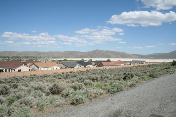
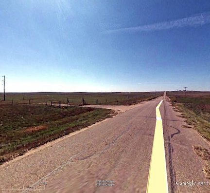
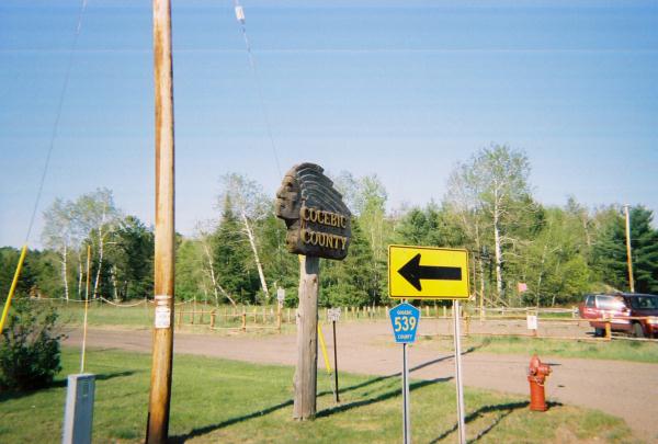
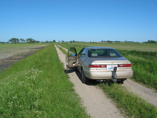
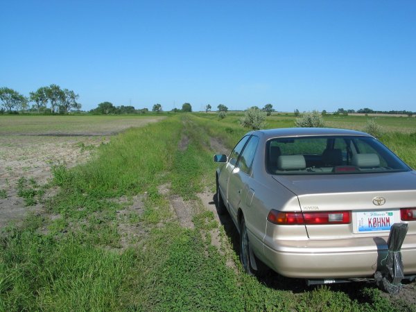
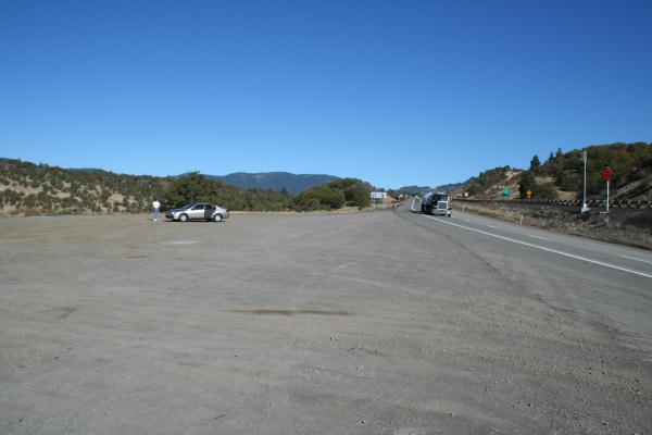
GENERAL LOCATION - About 20 miles west of Mobile Alabama and about 20 miles north and slightly east of Pascagoula Mississippi.
Specific Location - 30°38.20' North, 88°24.50' West. Elevation 110 ft. Mississippi State Road 614, Alabama State Road 56.
Directions - From the Mississippi side, exit Interstate 10 north of Moss Point (Exit 69) and take State Road 63 about 6 miles north to the intersection of SR 63 and SR 613. Follow SR 613 north about 11 miles to the intersection with SR 614 just south of the village of Hurley MS. (village means a roadhouse, a convenience store, a gas station, and two houses). Take SR 614 east 5.7 miles to the state line. From the Alabama side, take exit 3 (Airport Road) off I-65 in Mobile. Travel west past the airport and the road becomes State Road 56. Continue traveling west to the state line. It is about 18 miles from the I-65 intersection to the state line. The line is well marked and has a wide spot that allows you to set up without blocking the sparse amount of traffic (only half dozen or so cars drove by during the whole of the 40m early net). It is fairly deserted and seems to be often used as a dump. The propagation was good, with low noise. I operated on the evening of 02 June 2002 and made 55 contacts on the 40m early net. It was a typical June evening, warm and humid (or hot and wet!!).
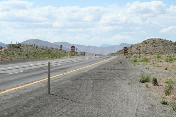
 Northbound |
 Southbound |
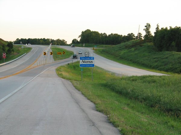
In the second picture, heading south into Arkansas, just above the Route 65 sign there's a right turn onto a secondary road a few hundred feet beyond the border sign. It's much safer to park there than at the border. There's no easy place to park, that I saw, while heading northbound.
Also note that there's a dead-end stub road approaching from the lower right. If you can swing around the blocking poles it seems a lot safer but some patrol officer may ask you to move. Note that this point is also lower and may adversely affect your radiation pattern. Equipment was an Icom 706MKIIG and High Sierra HS1800 screwdriver antenna with MFJ travel tuner.
 Eastbound |
Heading east on Rte 40 into Arkansas. In my opinion the level portion of the shoulder is too narrow to park safely, requiring parking farther off the road in the drainage area as pictured. Ground was firm, but might be soft in very wet weather. Caution running the engine while parked due to tall grass. Several civilians and one highway patrol car stopped to render “assistance.” No manmade interference heard. Parking opportunities on the westbound side are poor/dangerous due to a long guard rail on both sides of the border preventing parking a safe distance from traffic. Turn around at exits 5.25 miles east and 5.6 miles west if needed.
The town of Mesquite, NV sits on the line. A frontage road (Hillside Drive) is on the south side of I-15 and there is a wide pullout that is suitable to operate from, right on the line. This is right across from houses, so an idling big-rig might not be welcome. AD7DB operated here.
Tri-state corner. This point is not accessible by road
 Old Hwy 91 |
Take the Littlefield, AZ exit from I-15 and go about 8 miles north on what's called “County 91.” (This is the old US-91 highway.) There is a wide pullout at the line, but I don't think it's suitable for big-rigs. Highway is not deserted, but has light use. AD7DB operated here. See photo.
 Route I-15 |
I-15 about 8 miles south of St George. AD7DB investigated and found no suitable spot on the line that's on I-15. The truck scales are half a mile inside Utah on both sides of the highway. See photo.
The AZ-UT line was on an old dirt road about 10 miles south and east of St. George, UT. The coordinates were (from TOPO USA version 2.0) 37°0.000' North, 113°34.327' West, grid square DM37fa. The elevation was 2724 feet. The only visual indication was a single strand barbed wire fence and a sign “Welcome to Arizona,” half bent over and with the usual amount of bullet holes. The area was general high desert conditions, scrub and hard-pan; mountains to the West and North, general buttes, cliffs and bluffs to the East and South, but the take off angle was generally good. Noise conditions were good and the area was free from power lines.
The AZ-UT line was pretty well deserted until about 0200 when a forest service fire crew came roaring past from the Arizona side in a cloud of dust.
All the equipment worked well and I feel fortunate to be able to get to all four locations in time to check into the net; and more fortunate that people could work me. I had forgotten that, as you go west, the UTC time occurs earlier in the day. Another interesting facet is that the sun continues to shine and the whole early net was done in either sunshine or early evening sunset. By my estimate the sunset times were: AZ/UT 0230Z, ID/MT 0245Z, OR/WA 0330Z, CA/NV 0315Z. There was no need for the flashlight and the lamp that I used in previous mobile operations. The sun position meant that I could hear very few stations in the east - although the California, Oregon, Washington, Idaho and other mountain west stations were very 59. At some locations I could not even hear the net until 0100Z, and it was not until 0200 to 0230 that my signals could get east of the Mississippi; by then the eastern stations were swamped with foreign BCI.
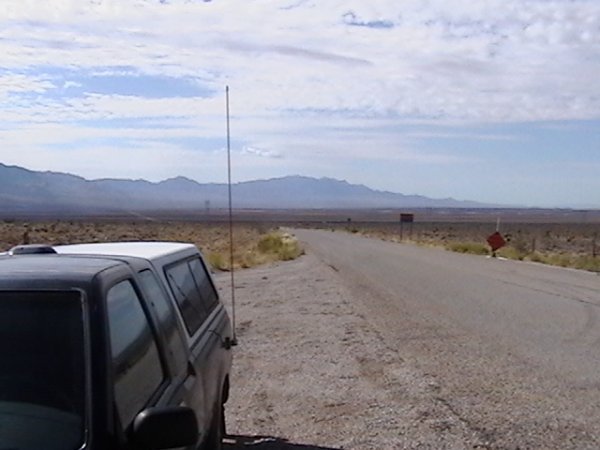
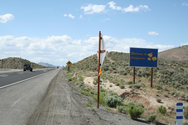
The CA-NV line was easy to find. You take the state road California 299 east from Alturas, over the Cedar Pass (elev 6305') down through Cedarville, past the sign that says “warning - no services next 100 miles” and out onto the middle of Alkali Lake. Continue on past the dry lake bed toward the Forty-Nine Mountains and when the paved road stops you are at the state line. Coordinates were 41°33.467' North, 119°59.924' West, grid square DN01an. Elevation is 4864 feet. At the end of the road there is a sign “Nevada State Line” and the other side was a dirt road. I did not go any further. The general area was dry desert with growths of small scrub. The take off angle was good to the West, North and South, but the East signal had to go over a 7300 foot mountain. Surprisingly, there was a power line next to the road, but the noise conditions were not too bad.
The CA-NV line was deserted and, except for the wind and the Nevada State line sign (with the bullet holes in it), I was left alone for the whole net.
All the equipment worked well and I feel fortunate to be able to get to all four locations in time to check into the net; and more fortunate that people could work me. I had forgotten that, as you go west, the UTC time occurs earlier in the day. Another interesting facet is that the sun continues to shine and the whole early net was done in either sunshine or early evening sunset. By my estimate the sunset times were: AZ/UT 0230Z, ID/MT 0245Z, OR/WA 0330Z, CA/NV 0315Z. There was no need for the flashlight and the lamp that I used in previous mobile operations. The sun position meant that I could hear very few stations in the east - although the California, Oregon, Washington, Idaho and other mountain west stations were very 59. At some locations I could not even hear the net until 0100Z, and it was not until 0200 to 0230 that my signals could get east of the Mississippi; by then the eastern stations were swamped with foreign BCI.
 NV Entering CA |
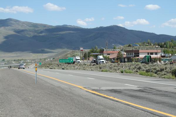 Looking South at Bordertown |
 |
 Looking North |
 CA Entering NV |
 NV Entering CA |
Here I am at the CA-NV line. The picture on the left is looking north and the other south. Not much room on the highway to set up an antenna, but Bordertown looks like it has some nice spots to get off of the highway.
If anyone wants to operate from this location go into the Bordertown parking lot and take the gravel road north a few hundred feet to the border. There is plenty of room there for portable antennas.
 Left (East) turn from Cemetery Road |
On east-bound I-80, exit at Pine Bluffs near the NE state line. If coming south from Torrington, county roads (probably paved) can be taken direct to Pine Bluffs. Proceed east through town to Cemetery Rd (County Rd 164). Head south on Cemetery Rd (paved, and probably the only road crossing under I-80) about 12 miles (all distances approximate) to CO state line. There is no sign, but the pavement changes character and there is an E-W power line crossing the road. Take farm track east (Google Earth can show you a street view of this turn) about 3/4 mile to the tri-point. This track runs on the south side of an E-W fence, and there are no gates to contend with. On my first try, this track was literally under water, so I didn't risk it. About half way along, there is a cattle watering tank which might be messy depending on how long it's been since cattle were present. Again, no gates or farmhouses and you are not visible from the paved road. The monument is at the corner of E-W and N-S fence lines.
I didn't camp there because it is only two hours from my house, but I wouldn't have hesitated. You can't get there from the east (or any other direction) without driving overland, through gates and fences, etc. But, from the east, you can visit the highest point in NE (for which the rancher requests a $2 donation).
 Go Right at Sign |
 Go Around the Gate |
 Go Left Onto the trail |
 Tri-State Marker |
The trail to the marker is 4.2 miles from I-395 exit 53. The tristate marker is slightly more than 1 mile down the trail.
From I-395 exit 53 take Wilsonville Rd east for 0.4 mi. Go right onto Thompson Rd (Rt 193) for 0.3 mi. Turn left on Porter Plain Rd 1.33 mi. Turn right onto Sand Dam Rd for 0.2 mi. Turn slight left onto East Thompson Rd. In 1.4 miles you'll cross into MA and the road name will be SW Main St. (No sign, but the pavement changes.) Proceed another 0.4 miles until you see High St on your left. The trail is opposite High St and there is room for several cars to park alongside the road.
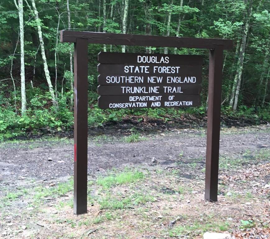
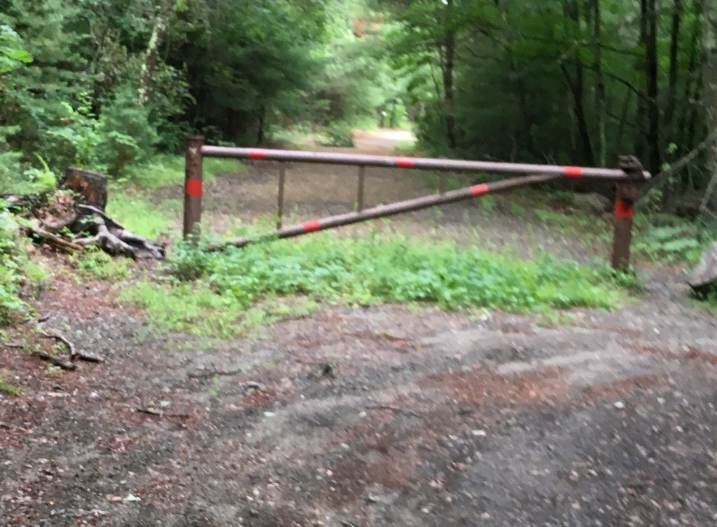
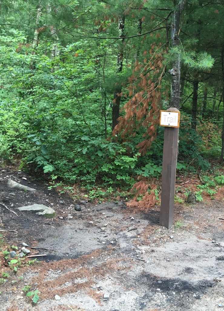
Apply bug spray. Follow the level trail for 1000 ft where you'll see a sign (see picture above) for Douglas State Forest. Take a right SW and follow the level abandoned rail line bed for 0.7 mi. You'll walk around a metal gate (see picture above) at the MA-CT state line and proceed a few hundred feet to a sign (see picture above) marking the trail to the monument on the left. A few feet up the trail is a granite marker for the CT-MA line. Proceed another 0.3 mile to the CT-MA-RI marker. The trail is a moderate grade, but rocky with tree roots. There is a clearing at the monument with room for a portable antenna.
 |
 |
The IA-MN-SD tri-state marker is a steel and concrete monument set into the ground in a small roadside park. There is vinyl fence separating the monument from a small parking area. The old rusty steel bridge has been replaced with a concrete span. An interesting oddity is that the east-west road has three different street names depending on which side of the border you are standing. It's 268th Street on the north (SD) side, 11th Street on the north (MN) side, and 100th Street on the south (IA) side. The north-south road at the monument is 488th Ave on the west (SD) side and 10th Ave on the east (MN) side. The monument seems to be a gathering place for local teenagers who wandered by in friendly groups several times. A state patrol car drove by once, slowing down until I waved, and they continued on without stopping.
DIRECTIONS TO THE MARKER
Directions from Sioux Falls - Drive east on Highway 42 from I-229. At the South Dakota-Iowa Border, Hwy 42 turns into Hwy 9. Turn left at 100th/268th Street just before the parking lot of the Grand Falls Casino. Drive east about 2.5 miles. The monument will be on your left at 488th Ave.
Directions from I-90 (East Bound) - Take I-90 to I-229. Go south on I-229 to exit 6 (Hwy 42). Turn left (east) on Hwy 42. At the South Dakota-Iowa Border, Hwy 42 turns into Hwy 9. Turn left at 100th/268th Street just before the parking lot of the Grand Falls Casino. Drive east about 2.5 miles. The monument will be on your left at 488th/10th Ave.
Directions from I-90 (West Bound) - Take I-90 to Minnesota exit 1 (Jasper/Pipestone). Turn left (south) onto County Road 17 (20th Ave). Drive about 7 miles to a tee in the road. At the tee, turn right onto 11th/100th Street and drive west about a mile. The monument will be on your right at 488th/10th Ave.
Directions from I-29 (North Bound) - Take I-29 north to I-229. Take I-229 north to exit 6 (Hwy 42). Turn right (east) on Hwy 42. At the South Dakota-Iowa Border, Hwy 42 turns into Hwy 9. Turn left at 100th/268th Street just before the parking lot of the Grand Falls Casino. Drive east about 2.5 miles. The monument will be on your left at 488th/10th Ave.
Directions from I-29 (South Bound) - Take I-29 south to I-90. Go east on I-90 until you connect with I-229. Take I-229 south to exit 6 (Hwy42). Turn left (east) on Hwy 42 from I-229. At the IA-SD Border, Hwy 42 turns into Hwy 9. Turn left at 100th/268th Street just before the parking lot of the Grand Falls Casino. Drive east about 2.5 miles. The monument will be on your left at 488th/10th Ave.
 |
 |
Here I am at the IA-MN-SD line. I got a dipole set up from the bridge to the traffic sign by the road. Next to the white fence is the tri-state marker.
Here's how you get to this point. Take I-90 in Minnesota to exit “1”. North of the Interstate this road is Highway 23, South of the Interstate this road is County Road 17. You take 17 south to the end of the road (about 8 miles). Turn right (West) less than a mile and you will see the marker on the North (right) side of the street, bordered by a low wooden fence.
 Border Sign |
 Operating Position Far View |
 Operating Position Close-up |
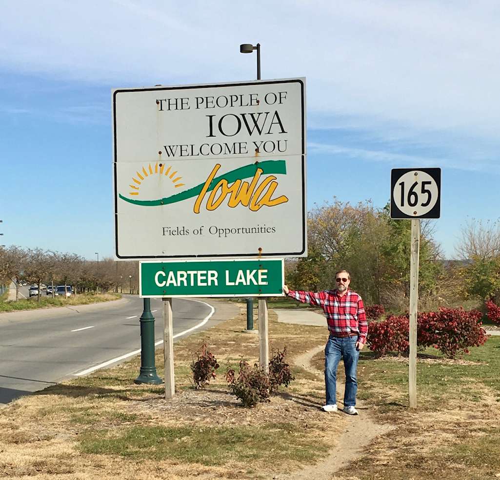
IA-NE I-480 AA0HF/KE0CFT Eric and Jayden 2016
The IA-NE dry border can be found on the west side of the Missouri River on Abbott Drive between downtown Omaha, Nebraska and Omaha's Eppley Airport. For a short distance, Abbott Drive crosses into Carter Lake, IA. The town of Carter Lake was created by a shift of the Missouri River long ago, and is the only Iowa town west of the Missouri.
Freedom Park, created when Abbott Drive was rebuilt into a four lane divided road, now provides a great location to operate on the border. Please note the recommended operating position is actually south of the main park near the riverboat dock, as the main park's visiting hours end at 8 PM. For those members interested in Naval history, Freedom Park has a United States Naval Museum.
DIRECTIONS TO THE OPERATING LOCATION [Recommended]
FROM THE EAST
FROM THE SOUTH
FROM THE NORTH
FROM THE WEST
The GPS coordinates of the recommend operating location are N41° 16' 25.68", W95° 55' 04.62".
Cellular network coverage: There was Sprint 3G and Verizon LTE coverage at the operating location. We were able to run NetLogger live on the Sprint network.
ID-MT (DN26) (Idaho county, ID - Missoula County, MT). The Lolo Pass Visitors Center on Hwy 12 has been built since my last time over this pass. Lots of parking, and the Forest Service has Wifi if you ask. Big trees for antennas if you have a sling-shot. The Lolo Hot Springs Resort is just down the hill in Montana. If you have $$$, this is the place for you. Lolo Hot Springs Resort
The ID-MT line was on an old asphalt road about a quarter mile from and parallel to I-15. The coordinates were 44°33.525' North, 112°18.294' West, grid square DN34un. The elevation was 6830 feet. There were no visual indications (there were signs on the interstate), but there was a very large junk yard and the owner (who came out to see what I was doing) said that the north side of the yard was on the line. The area was on the continental divide (I spat on both side to see what would happen) and the general condition was high plains with scrub vegetation and rolling hills. The area was called Monida Pass, but the mountains were not especially bad and the take off angle was ok. Noise conditions were again good and the area was free from power lines.
The asphalt road on the ID-MT line also looked deserted, except for the owner of the junk yard, but it must have gone somewhere because about a half dozen cars drove by during the net. Three stopped and asked if I needed help.
All the equipment worked well and I feel fortunate to be able to get to all four locations in time to check into the net; and more fortunate that people could work me. I had forgotten that as you go west the UTC time occurs earlier in the day. Another interesting facet is that the sun continues to shine and the whole early net was done in either sunshine or early evening sunset. By my estimate the sunset times were: AZ/UT 0230Z, ID/MT 0245Z, OR/WA 0330Z, CA/NV 0315Z. There was no need for the flashlight and the lamp that I used in previous mobile operations. The sun position meant that I could hear very few stations in the east - although the California, Oregon, Washington, Idaho and other mountain west stations were very 59. At some locations I could not even hear the net until 0100Z, and it was not until 0200 to 0230 that my signals could get east of the Mississippi; by then the eastern stations were swamped with foreign BCI.
I had planned to do this point on the trip, but after reviewing the route I thought better of it at this time. However, I decided to drive to the gate that marks the start of the pack trip just to make sure of its location. Parsell describes the route from Macks Inn on Highway 20 (along the Big Springs Loop road, FR 059), but it's a bit shorter from the north terminus of the loop road, at about 2 miles north of Mack's Inn. It's about 13 miles from the highway to the gate on FR 066, and it will be about 6 miles from the gate to the crossing of Thirsty Creek where you begin the 4 mile cross country trek to the point. The gate appears to be where Parsell predicted it would move in 1997 (two miles back from where he encountered it).
The Big Springs Loop road (FR 059) is an excellent county-maintained road, even paved in spots. FR 066 is a typical 1 and 1/2 lane forest road, but is in surprisingly good condition for a road that basically goes nowhere (for us, anyway). It's easy to go too fast (oops, a couple of times). There are few side roads or turnouts or places to park for camping (becoming too typical I fear). But it does cross the Continental Divide Trail, so there's that.
Perhaps I'll do this one next year or in another life, whichever comes first. Now on to planning AZ-NV-UT, which is another hike, darn the luck.
ID-NV (DN21) Jackpot, Nevada (Elko County NV - Twin Falls Coounty , ID). Hwy 93, a paved pull-off right at the border... or if you have 4-wheel drive, take the unpaved road to the west up to the cell tower on a hill for better elevation and so the hill doesn't block signals to the west. Several Hotels/Casinos in Jackpot NV.
This was my second trip here. On the first I operated mobile from the base of the ridge on which the monument is located and was able to hear the early SSB nets fine, but was unable to get checked in. This was probably due to the fact that I was down in a valley and basically in a hole. I was able to get on 40 SSB Late, however.
This time I packed up the ridge and camped adjacent to the monument on a flat, but not too flat, section of the ridge. This time I was able to get checked in and worked many stations on both 40 and 75 SSB early nets. The band was very quiet for me and most stations were S5 or above.
I was operating a Yaesu FT-817 into an HFPacker amp at 50 watts to an AD5X vertical antenna. There is a massive, transcontinental electricity transmission line a couple of miles away, and a fairly large power line just down the valley, but these seem to have no effect on conditions. This area is pretty remote and very, very quiet, almost too quiet...
ID-WA (DN16) (Latah County, ID - Whitman County, WA). West of Moscow, ID on 270. Heading west from Moscow, ID, turn right on Warbonnet Dr about 200 yards before the border, go roughly 1/4 mile and see a large Mormon church on your left. Parking in the westernmost edge of their large parking lot places you on the line. Some trees would support a wire antenna, but they are not very tall. Just to the south (about 175 yards) is a La Quinta motel, also on the border. Moscow has a few Club Stations W7UQ and KD7PH, so if you can plan ahead, maybe some "guest ops" could be available. Wifi is available from La Quinta & Walmart, both close to the Morman Church.
There are several places to be on this line near East Dubuque, but the one I like best is near Hazel Green. It seems to be most clear of residences and has a nice turn out. That building right on the line is just a warehouse. Good luck I will listen for you.
I came within 2 calls of getting my 40M Nomad award without moving. Finding the tri-state point was the toughest part. There's a historical marker that I passed 3 times before I realized it wasn't just a big pointy rock. And according to the marker, the marker wasn't even on the point. I had to pace off 130 feet south of the marker where I found a Williams County (Ohio) road marker. I figured that had to be the spot (shame on me to forget my GPS).
The actual location was Township Hwy 10, about 3/4 mile south of West Territorial Road (Rt 120) in Hillsdale County, MI. Hwy 10 is a gravel road directly across from the “Indiana State Line” sign on Rt 120. (Or just before the “Enter Hillsdale County” sign if you're heading East. (Someone was collecting these (WC0PD?) I think - It would be hard to park a big rig there, but in over 3 hours I was only passed by 2 cars. And a as a big bonus, I heard Orin (VY0DU in Nunavut) for the first time on my drive home - and he heard me!
WA2JIM:
Jeff and all:
I have been to IN-MI-OH and it's not the easiest corner of the world to find. It is a semi-gravel road, as opposed to paved. Coming from 80/90 exit onto I69 South. Find the exit for “N 200 W” and go North. Then you will turn right onto “W 200 N” It should be the next intersection. You will travel quite a few miles, near the end you will go under 80/90. You will cross Old Road 1, and then the road you're currently on curves to the left, which is North. You are now on IN/OH. Look for the marker on the right side of the road, about 1.5 miles north of the curve. It will be a little bit past the first road on your right. The next road will be a T and you have gone too far.
 Turn Here |
 Monument |
 Operating Location |
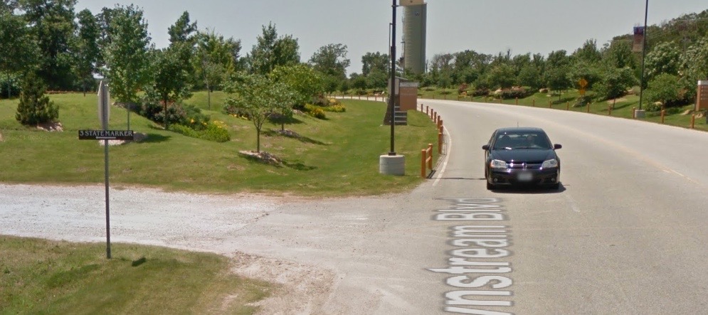
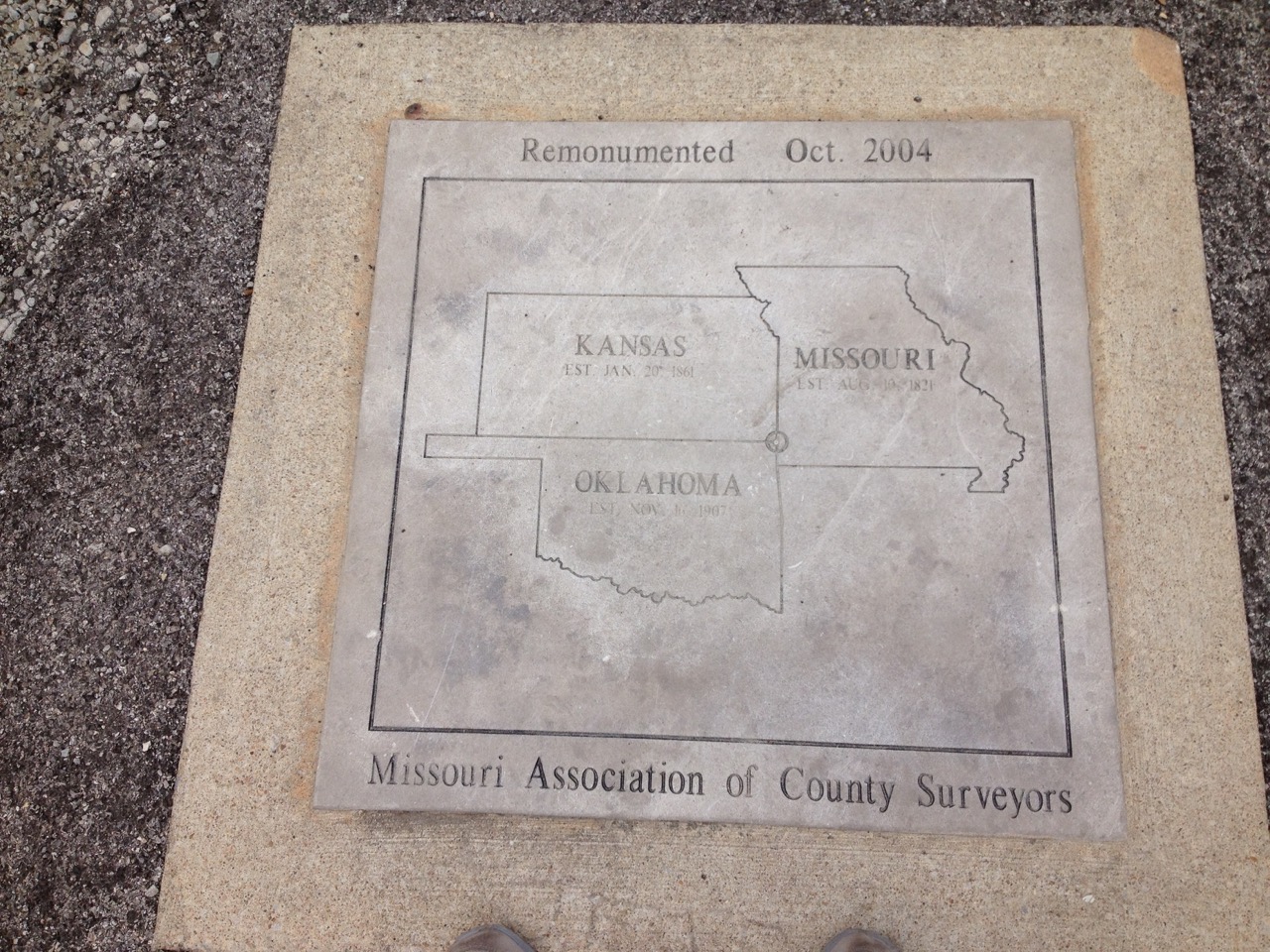
The Kansas, Missouri, Oklahoma tri-state marker is a flat monument set into the ground at the end of a gravel road. There is a short wooden fence around the monument. There is also an old stone structure nearby, but that no longer appears to be the current marker. While I was there a few cars stopped by to look at the monument, but otherwise no traffic. Security from the casino stopped by to render assistance based on a report of a broken-down car. Security was very friendly and there was no issue with operating from the location. Good Verizon 3G coverage.
DIRECTIONS TO THE MARKER
From The East (Joplin, Springfield):
Follow I-44 westbound to Exit 1 in Missouri (Baxter Springs, KS – Highway 166 exit). Bear right off the exit ramp and continue one quarter of a mile to the roundabout. Follow the signs to the entrance to Downstream Casino Resort. As soon as you exit the roundabout, turn left onto a small gravel road marked with the road sign “3 STATE MARKER.” The marker is at the end of the gravel road.
From the West (Southeastern Kansas):
Proceed east on Highway 166 toward I-44. The entrance to Downstream Casino Resort will be on the west (right) side of the highway approximately one quarter of a mile before the entrance to I-44. As soon as you turn right on the casino entrance road, take an immediate left onto a small gravel road marked with the road sign “3 STATE MARKER.” The marker is at the end of the gravel road.
From The Southwest (Tulsa, Oklahoma):
Follow I-44 eastbound to Exit 1 in Missouri (Baxter Springs, KS – Highway 166 exit). Turn left at the stop sign at the bottom of the exit ramp and proceed back under I-44 another 0.3 miles to the roundabout. Follow the signs to the entrance to Downstream Casino Resort. As soon as you exit the roundabout, turn left onto a small gravel road marked with the road sign “3 STATE MARKER.” The marker is at the end of the gravel road.
From The South (Northwest Arkansas, Neosho and Anderson, MO):
Follow I-540/U.S. Highway 71 northbound to I-44. Take I-44 westbound to Exit 1 in Missouri (Baxter Springs, KS – Highway 166 exit). Bear right off the exit ramp and continue one quarter of a mile to the roundabout. Follow the signs to the entrance to Downstream Casino Resort. As soon as you exit the roundabout, turn left onto a small gravel road marked with the road sign “3 STATE MARKER.” The marker is at the end of the gravel road.
From the North (Western Missouri):
Follow U.S. Highway 71 southbound to I-44. Take I-44 westbound to Exit 1 in Missouri (Baxter Springs, KS – Highway 166 exit). Bear right off the exit ramp and continue one quarter of a mile to the roundabout. Follow the signs to the entrance to Downstream Casino Resort. As soon as you exit the roundabout, turn left onto a small gravel road marked with the road sign “3 STATE MARKER.” The marker is at the end of the gravel road.
 Skip, K5SRG, northbound |
 Ben, AE4NT, northbound |
Skip and Ben worked the LA-MS border on US Hwy 61 on July 13th 2015 as one stop of Ben's infamous “Hooters Tour.”
You can read the history and a state by state route description of US Hwy 61, aka the Blues Highway.
Just south (115') of the sign in the pic is a private drive that drops off from the highway at a pretty steep slope. As seen in the pic the highway shoulders at the border are good, but the traffic going either way is moving along at a good clip - speed limit 65. We decided sitting at either location in the dark wasn't particularly safe. From where the picture was taken you can look back south and see the “entering LA” sign. Sorry I didn't get a pic of that.
Still looking South, on the southbound side of Hwy 61 there's a truck stop / convenience store / grill / casino (at Taylor Rd, St Francisville, LA 70775, visible on Google Maps satellite view, the red roof) that's up on a good rise. This seemed a much safer spot. We happened to catch the night casino security guard coming into work and explained to him why we would like to sit in the parking lot behind the place for a good part of the night. He was good with this.
Ben and I were in separate vehicles having both driven up from Baton Rouge where we'd worked from a hotel the night before. We parked about “72 bobcat lengths” from each other. We managed to work all four SSB nets that night with pretty good signal reports with most stations. LA contacts in general seemed to be desirable based on this and the previous night's activity.
The counties involved are West Feliciana Parish in LA and Wilkinson County in MS. See Eyeball 2015 Shootout Results for equipment info.
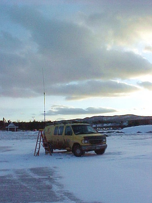
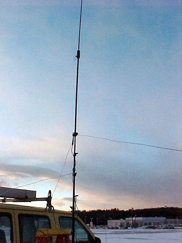
 "Ol" Dodge with Buddi-pole |
 |
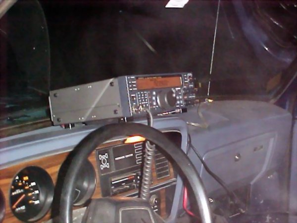 TS-750 |
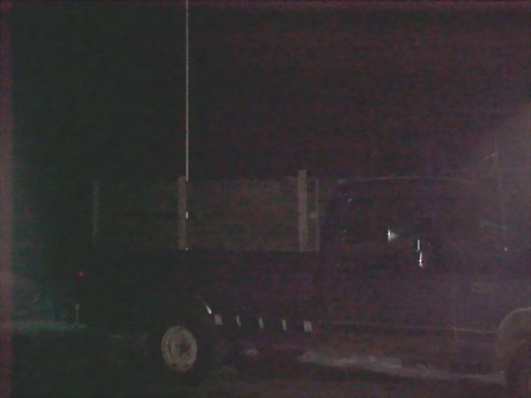
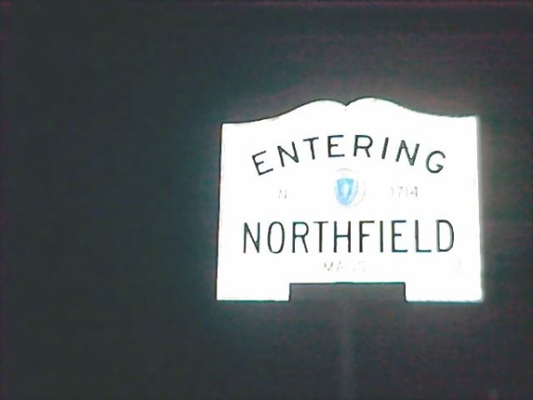
Just some info on being Portable MA/NH. I was on Rt 63, on the Northfield / Winchester line, at the Northfield drive-in. If you go to Google maps, you'll see the drive-in screen and the driveway where I was parked. Sending along some pics, came out kind of dark, but you should make out the “ol” dodge with the buddi-pole and TS-570.
Nice parking spot to run Maine Cap.
Take I-95 to exit 112A in Augusta, Maine. This is Civic Center Drive, Routes 8, 11, and 23, and the last Augusta exit when heading north on I-95.
Head south towards downtown Augusta and the U. Maine, Augusta campus. About 1/2 mile from the interstate, see the entrance for the Augusta Marketplace on your left. Go to the second entrance for the marketplace, take the left to enter, and proceed up the long hill to the top.
From here, you can see and take your choice of many high and wide open places to park.
I stayed to the right and parked way over near the railing in the Sam's Club parking lot. It was wide open for great distances with few light poles, people, other cars or trees. I had a great place to park near the edge of the big hill, and a panoramic view for miles around and below my location. Also, there was a steep drop off just beyond the railing for those needed QPP trips after drinking two one liter bottles of water and a 16 oz coffee during the nets.
 Route 2, 7 mi to border |
 Route 2, Entering NH |
 Route 2, Logging Road |
 Route 2, Entering ME |
Traveling west on Route 2 from Bethel, ME, -- 20 years ago GE sent me here for a special week-long training session so I had to re-visit the place - picture 2 is where you hit the NH border. Went too far. Just before the border there's a logging road off to the left which is an OK place to park, but there are lots of trees and a few hills around. I still managed to be heard pretty well. There are no power lines or electrically noisy towns nearby. Picture 4 is heading back into ME after crossing the border. Logging road is off to the right.
Equipment was an Icom 706MKIIG and High Sierra HS1800 screwdriver antenna with MFJ travel tuner.
 Route 202, Entering ME |
Wet border. No place dry. Not allowed.
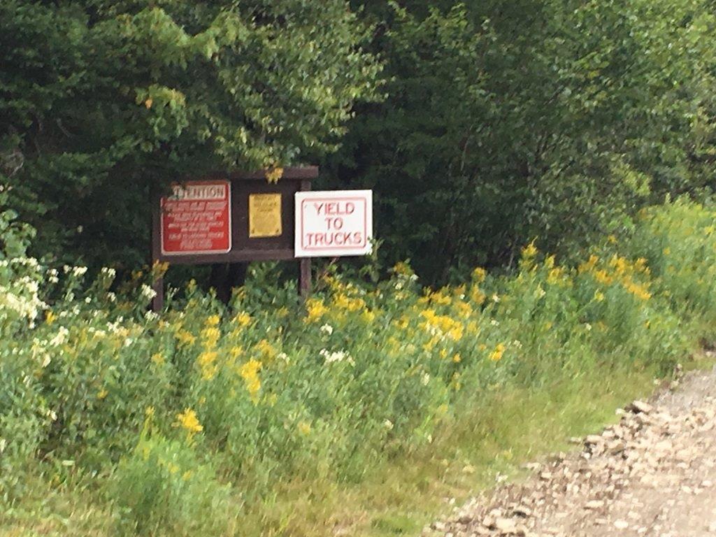 Photo 1 - Signs at beginning of E Inlet Rd. |
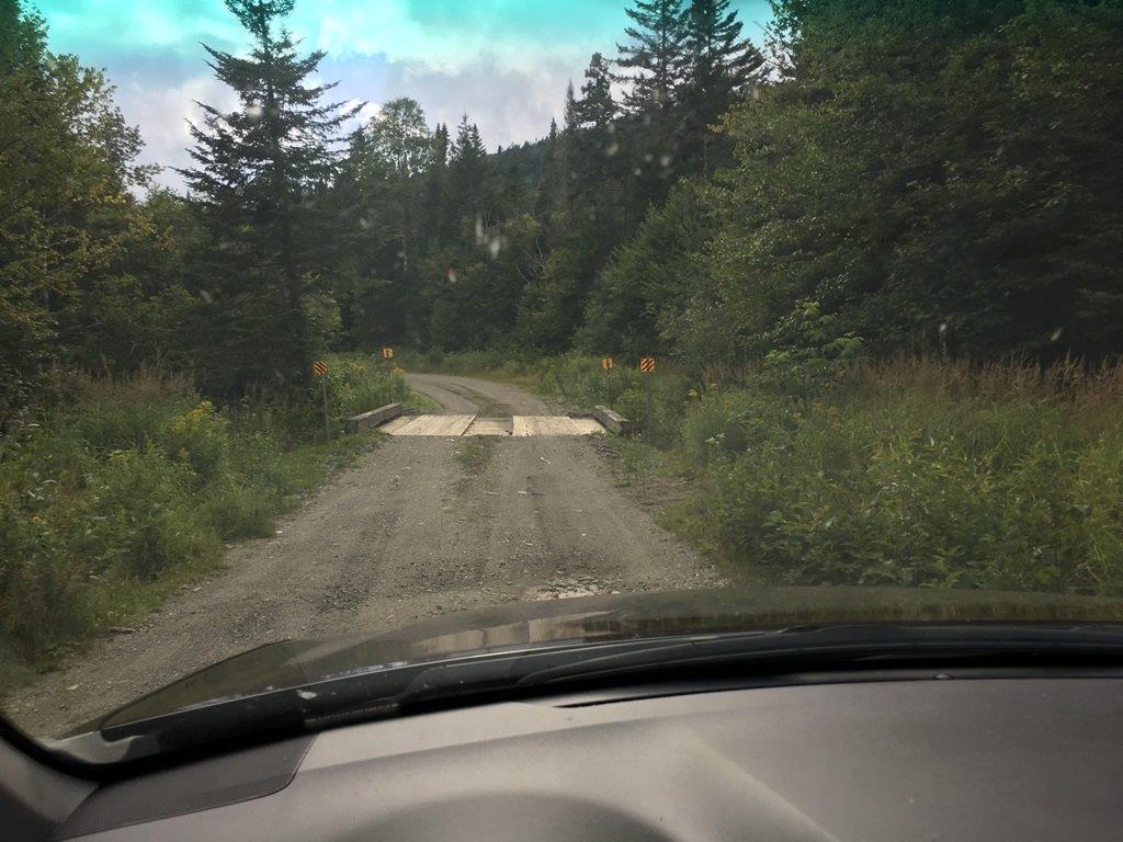 Photo 2 - Wooden plank bridge. |
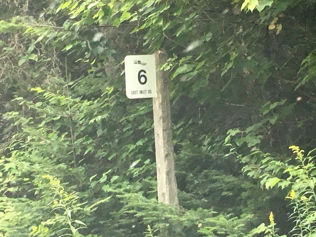 Photo 3 - Mile marker on E Inlet Rd. |
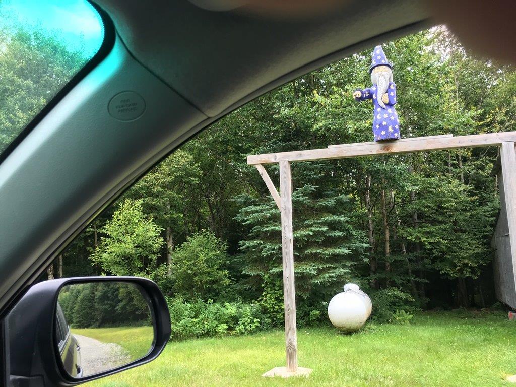 Photo 4 - Purple wizard at 6.5 miles. |
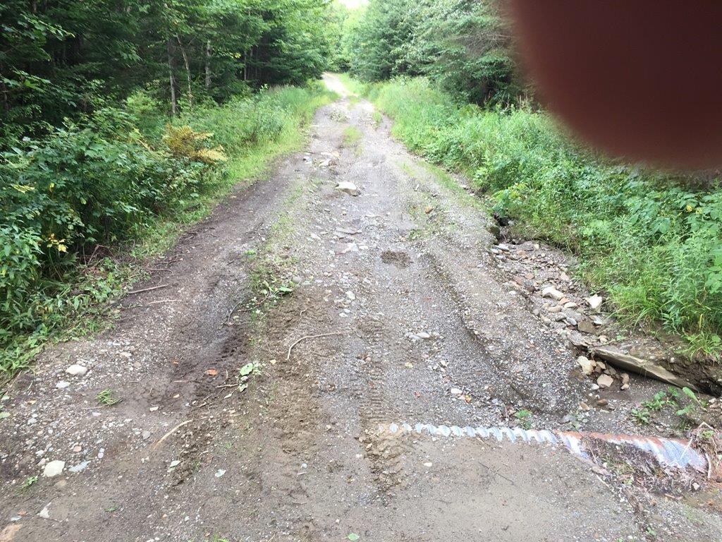 Photo 5 - E Inlet Rd is rough beyond Boundary Pond Rd. |
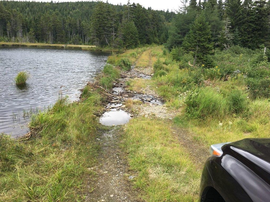 Photo 6 - E Inlet Rd impassable at Rhubarb Pond. |
I can't see myself doing this at night. At least 30 miles from cell service or nearest help (except possibly the wizard). Seems like a good destination for a Saturday afternoon 20M net.
Make your way to US route 3 in Pittsburg, NH. Proceed north about 15 miles to mile marker 236.5. Take a right onto East Inlet road. (Photo 1). I didn't have any cell service north of Pittsburg and my car GPS didn't show all the roads branching off of East Inlet road so I recommend you bring a topographic map of the area. Proceed on East Inlet road. In 0.3 miles you'll cross a wooden plank bridge (Photo 2) and come to a tee in the road. Take a right (south). Continue to follow East Inlet road for another 13.1 miles. There are several wooden plank bridges, but there are yellow signs warning when you are getting close. There are mile posts with white signs (Photo 3) showing the distance from the beginning of East Inlet road. The first 5 miles of the road is well graded with occasional ruts, pot holes and large rocks. It gets progressively rougher beyond 5 miles. At about 6.5 miles there is a house with a purple wizard. (Photo 4) At 8.3 miles there is a kiosk with a detailed topographic map of the area. At about 12 miles there is a sign post for Boundary Pond road to the left. Boundary Pond road is graded better than East Inlet road. East Inlet road gets very rough from this point. (Photo 5) At 13.4 miles the road becomes impassable for all but 4WD / high clearance vehicles where Rhubarb Pond has spilled over and eroded the roadway. (Photo 6) My measurement on Google maps shows that the closest a normal vehicle could get is 0.52 miles from the tri point – outside the 0.5 mile requirement. I did not walk up to the tri point on this visit, but it can't be more than a mile.
 State line on US 45. Looking north from Wisconsin into Michigan |
 State line on US 45. Looking south from Michigan into Wisconsin |
 The Indian head is on the line; you can see my vehicle in the parking lot in the background |
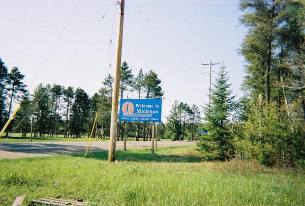
LAND O' LAKES, WISCONSIN (46°9.5' North, 89°13' West) lies right on the Michigan - Wisconsin border. The state line is well marked on US Hwy 45 and there's a secondary road right at the line. The best location is in the village, in the parking lot right behind the community building and library.
DRIVING DIRECTIONS.
FROM THE SOUTH go north on US45 through Eagle River, WI. Continue north for about 19 miles and you will come to County Road B; the signs for Land O' Lakes will point toward the west. The state line on US45 is about 200 feet further north and is well marked.
FROM THE NORTH from the Watersmeet, MI intersection of US2 and US45, go south on US45 for 7.5 miles to the MI-WI border.
TO THE VILLAGE. From the intersection of US45 and Wisconsin County Road B go 0.63 miles west into the village. Turn right (north) on East Duck Lake Road, go past the community building/library and turn into the parking lot.
INFORMATION
If it is winter time you will not be alone - the parking lot is also the trail head for a major snowmobile route. Coordinates: 46°9.775' North; 89°13.067' West, Elevation 1712 feet.
 Operating Position |
 Marker - ND Side |
 Marker - SD Side |
MN-ND-SD I-29 AA0HF/KE0CFT Eric and Jayden 2016
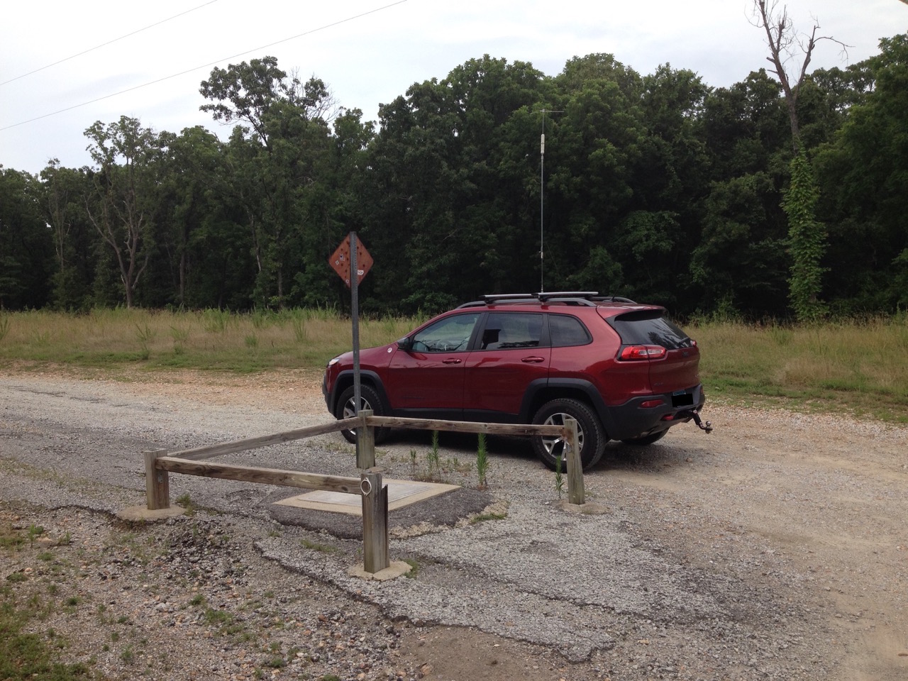
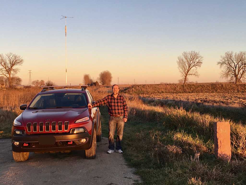
The Minnesota, North Dakota, South Dakota tri-point marker is the original 1891 stone monument (red jasper) set into the ground at the end of a half-mile track farm road, which will likely be unplowed in the winter and risky in muddy conditions without a four wheel drive vehicle. We were there when conditions were dry and had no problem getting to the marker with the Jeep. However - there is limited space to turn a vehicle around at the end of the track.
If you can get to the area a few hours early we strongly suggest going out while it is still daylight to find the operating location. That will help you find the unmarked turn and survey the condition of the track down to the marker. We found the monument during the daylight and went back to the casino for dinner.
The closest landmark to the tri-point is the Dakota Magic Casino at I-29 Exit 1. They have decent food and a small hotel, where we spent the night after activating the tri-point.
DIRECTIONS TO THE MARKER [Recommended]
From The North, South, East and West:
Make your way to I-29 North Dakota Exit 1. Exit eastbound. You are on the border, so streets have both North Dakota and South Dakota numbering. Proceed east on 100/102nd Street and continue east past the casino.
Just past the casino's gas station, follow the road as it curves to the right onto 468th Ave and proceed south. Note: Although the monument is on 100/102nd Street, the road ends in a field before you get to the monument. So this detour is required.
Drive south about a mile and turn left (east) on CR-25/101st Street.
Drive east 5.1 miles until you pass Lake Street. The paved road ends at this point and becomes gravel. Keep going east on CR-25 another 4.8 miles on the gravel road where you will pass Hwy 127. The pavement will re-start. Keep going east on CR-25 another 1.9 miles until you reach 480th Ave, which is an un-marked gravel road on the edge of a large stand of trees just before the ghost town of White Rock. If you enter White Rock (aka Haggert Ave), you have gone too far. Turn left (north) on 480th Ave. Here is a map image of the turn: Google Maps Link
Drive north 0.9 miles north on 480th Ave until you reach 102nd Street. Turn right on to the two-rut track. At this point you are 1/2 mile from the monument. Check the track's condition before you proceed!
Proceed east 0.5 miles on 102nd Street to the end of the track. The marker will be on your right between the track and the drainage ditch.
The GPS coordinates of the marker are 96°, 33 minutes 49.32 seconds West; 45° 56 minutes 06.72 seconds North.
Cellular network coverage: There was Sprint 3G and Verizon LTE coverage at the site, although the Sprint coverage faded in and out. We were able to run NetLogger live at the site on the Verizon network.
 White Rock Eastbound |
 Road North out of White Rock |
 Track road heading East to Marker |
 Field Ruts East to Marker |
 Bois de Sioux Near Marker |
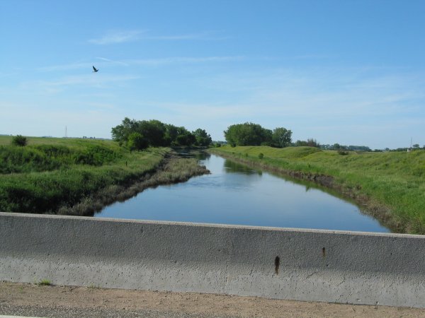 Border Bois de Sioux River |
 ND-SD Border |
 ND-SD Border |
 ND-SD Border |
 Junction Marker |
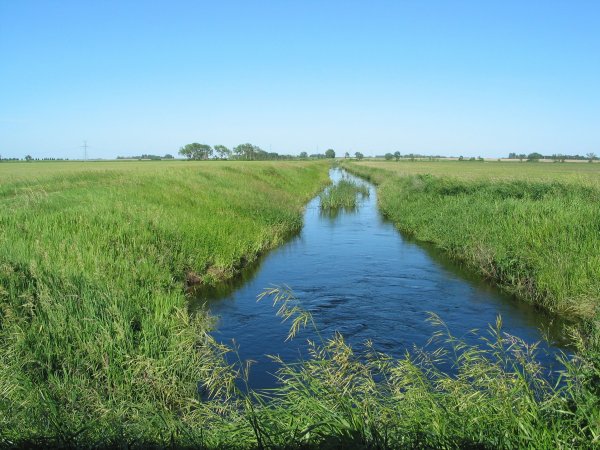
Travel Route 75 north or south in the western part of MN. Turn onto Route 16 (near the ND/SD border) traveling west. A mile west you cross Route 9 which runs north/south and is a graveled road. 1/4 mile more brings you through the ghost town of White Rock. It has one house boarded up and a big rock painted white on the western edge of the 200' town. Just past that rock is a gravel two-tracked road to the right (north). It looks like it turns into a corn field because it does and is made for farm tractors. Approximately one mile north is a two-track road to the right (east) in considerably worse shape than the tractor road. Keep car tires on the center hump and one side or the bottom of the car will drag. Do not cross mud holes. If you get stuck it's a 2.0 mile walk to the nearest farm to get someone to pull you out if they might be willing. I got within 2 blocks of the river and marker. The river has shifted over time leaving the marker on “dry” ground. The mosquito density was >25 per cubic foot and they were capable of penetrating the air circulation system of a 1999 Camry at will. Be sure to take repellant if mosquitoes are present at all.
Equipment was an Icom 706MKIIG and High Sierra HS1800 screwdriver antenna with MFJ travel tuner.
If you continue on past White Rock due west, in 1/2 mile you come to the junction of Route 127. Turn right (north) and 1/4 mile later you reach the ND/SD border which is much more hospitable with reasonable parking off road. Extra pictures included.
 I-90 WB Rest Area |
The MN-SD border on I-90 is near the rest areas located on both the Eastbound and Westbound sides of I-90. The border is about 14 miles east from the Sioux Falls airport. Ginger (AB6YL) reports it is well lit, pretty safe and has bathrooms. If you come from the west there is an exit ramp about 1 mile further east where you can get back westbound if you're staying in either the Brandon or Sioux Falls, SD area. The WB side works best as there are high power lines running along the EB side.
 |
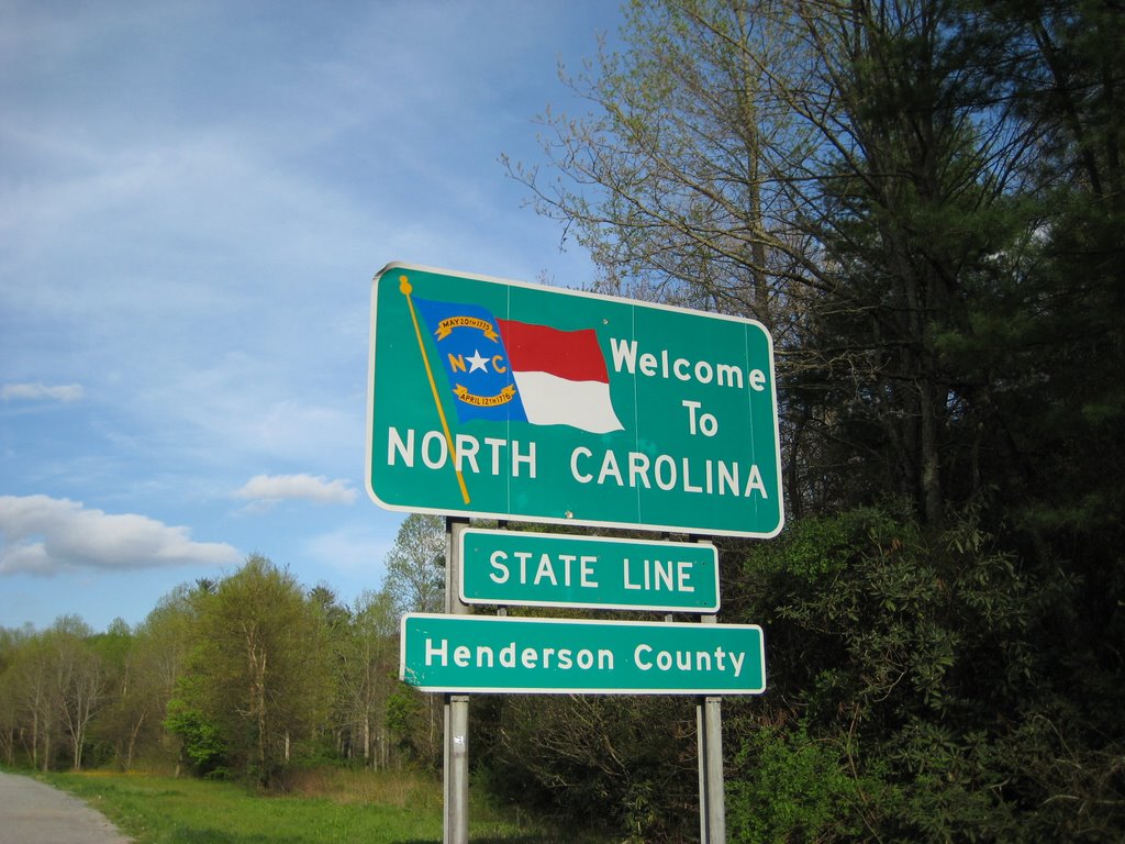 |
On July 15, 2015, I worked the 40m SSB nets from the North Carolina/South Carolina state line as the season finale of my “Hooters Runner” tour. After working the LA-MS state line with Skip (K5SRG), I decided to drive to Asheville, NC, so I could do some hiking in the mountains. Alas, there were thunderstorms the entire time I was there, so I had to settle for some radio operating instead, albeit under horrible conditions.
U.S. Highway 25 south of Hendersonville, NC is a busy, four-lane, divided highway. At the point where the state line sign is placed, there is a narrow road leading north that leads to a cell tower. Just before I got to the cell tower, I found a turn-around area where I parked. Coordinates are N35° 10.542', W82° 27.191'. As measured in Google Earth, this spot is about 43 feet from the state line.
With rampant thunderstorms, operating conditions were bad, so I can't say whether the cell tower and adjacent transmitter shack generated any significant noise. In any case, I made 20 contacts in spite of the QRN, the most distant being Oregon. The great thing about being next to a cell tower is that even when the 75m early net failed to materialize, I could bide my time playing on the Internet.
Operating condx were IC-706 Mk IIg at 100W into a hitch-mounted Tarheel 400A.
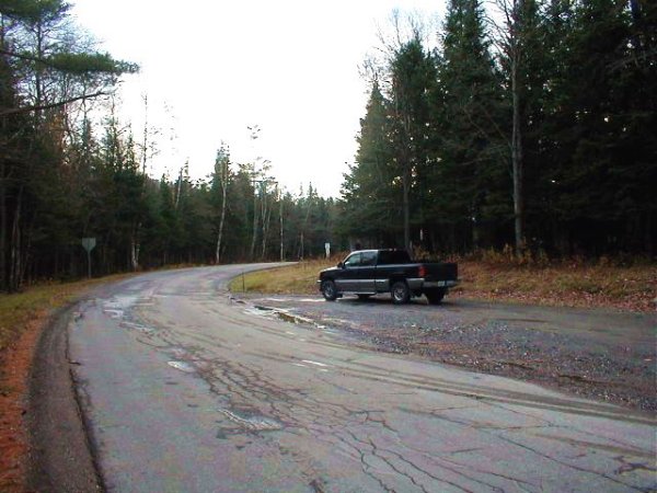
Traveling north of Lusk on US 18/85 about 13 miles to Hat Creek (nothing there), take Cty Rd 64 (Hat Creek Rd) east (there is a street-type sign here). This is a very good, county-maintained, two-lane, dirt road until you get to the fateful Jordan Ranch road (see later). At about 11 miles, this road jogs due south for about a mile and a half, then jogs back easterly. About 5 miles further along the road forks: take signed Cty Rd 60 (Indian Creek Rd) north. If I remember, Hat Creek Rd continues a little east, and then turns abruptly south again. Indian Creek Rd goes north a short bit, then NW, then east. About 6 miles along, there will be an intersection with Cty Rd 22 which runs south to Whitman. Keep going east along Indian Creek Rd about another 4 or 5 miles to almost the NE line. Note that it is getting very lonely; you are a long way from the paved road, and there are very few farmhouses out here.
Just before the NE line there is a good, one-lane farm road to the north. There should be a sign indicating Jordan's (5 mi), and Leuken's (2 mi ?). If you miss this, the state line has no sign, but the road changes character (becomes much less nice). The Jordan Ranch road is the first good northbound road west of the state line. Oddly, Parsell's book recommends approaching this intersection from the east; not for me, especially if the road is wet.
CAUTION: If the Jordan Ranch road is muddy (indicated by your tires throwing mud), back away carefully and leave! The only place to turn around is Leuken's (just a barn), and I wish I had on my first trip. The narrow road has barrow ditches (mires if wet) on both sides all the way to Jordan's. The road is coated with about two inches of clay, and when wet is VERY slippery as well as sticky. There are several up and down patches where the road crosses stream beds. As I started down the down-side of these, my pickup started sliding even though I was traveling as slowly as I could. The mud pushed back on the front tires causing the back end to swing out toward the ditch. I was then forced to accelerate to an uncomfortable speed in order to keep out of the ditches. On the up-side, I needed to switch into 4WD to make it up (only have highway tires). At one of the stream beds, the road is a dam, with a pond on one side and a cliff on the other. As I couldn't turn around, I was forced to cross this and it took quite a while to screw up enough courage to cross on the way back. Ironically, if dry, this road is no trouble at all, even traveling in a car, and you will wonder what all the fuss was about.
Anyway, drive the five miles north to the Jordan Ranch. Although the maps show lots of criss-crossing dotted roads here, there is only a single road with no real forks. As you approach the “ranch house” there is a red or orange metal gate on the right between the house and the barn. The route goes through this gate; do not take the road around the house to the left - you will get caught behind fences. I don't think anyone actually lives at the house; it appears to be just a break room for the ranch hands (could be wrong). Anyway, it is closed up tight during fall, winter and spring. This was as far as I got on my first try.
On my second attempt, after trying the road to the left, I returned to the house. While I was wondering which way to go, a ranch hand arrived and gave me directions to the monument. The compass directions given here might be wrong in an absolute sense; they are based on the assumption that as you approach the house, you are pointed north. Although the ranch approach road trends north, it winds a bit, and my sense of direction is easily confused. The whole distance from the house to the monument can't be more than a mile or two.
Pass through the gate and continue up the hill to the right (NW-ish). You will pass through one wire gate. At the top of the hill, there is a large water tank on your left (enclosed, not an open stock tank). At this point, the road forks: take the right-angle fork to the RIGHT (S-ish). If you go straight, you run into a fairly large, dry stream bed (this might be where WK7K and WT0A went wrong). This right fork then swings immediately around to the left (E-ish). A short distance later, the road forks again: take the LEFT right-angle fork (track) (NE-ish). If you miss this, you again run into the dry stream bed. At this intersection you might see an old bulldozer at the top of the hill in the direction of the final track. Anyway, the monument is just up the hill from this last fork. This is a very lonely place. I camped overnight, which I think is fine because I ran into the ranch hand the next morning and he just smiled and waved and didn't take any pot-shots or anything.
There is a register book at the monument - it indicates that people go up there during hunting season, although one probably needs permission from the ranch owners to hunt.
 Line North |
 Line South |
 Map Courtesy WM0F |
 Marker MarkerOld Canaan Rd, NH & River Rd, VT |
 Marker MarkerOld Canaan Rd, NH & River Rd, VT |
 QSL Card/Map Courtesy W2UJ |
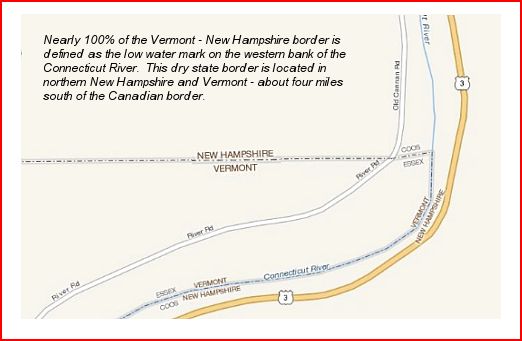
From the Junction of US Rt 3 and State Rt 26 in Colebrook, NH, go North on US Rt 3. Pass the 45th parallel marker at about 8.4 miles. Continue north on Rt 3 and at about 12.7 miles total, cross a bridge over the CT River on the Pittsburg town line. Pull the flaps here because... Just after crossing the bridge and at about 12.8 miles, take a hard left onto Old Canaan Road. Go south on Old Cannan Road about 0.7 miles to the pull-over on the right and the stone border marker is right at the end of the pull-off. This is a very lonely spot late at night. The only vehicles I saw were Border Patrols.
GPS Location: 45°0.8333' North, 71°27.9667' West
In the shot facing north, that light area at the far end of the road is actually the CY River.
I-40 at the line. There is a town called Glen Rio. A frontage road on the north side of I-40 gives access to the actual state line for cars. Not recommended for trailers or big-rigs, as it's a dead end road and hard to turn around from. N7JY and AD7DB operated here.
US-6/50 at the state line, northeast of Baker, NV and Great Basin National Park. Plenty of room for big-rigs and cars to park precisely on the line and safely off the highway. There is a motel, restaurant and gas station here.
NV-OR (DN01) Denio, NV (Humbolt County, NV - Harney County, OR) Parking is on enlarged area of the road shoulder. There is a Bar-Restaurant-Gas station as well as an airfield in Denio Junction about 2.5 miles south on Rt 292.
The location for NY-PA is accessed as follows:
From I-90 eastbound, take the first exit east of the PA-NY line, approx. 1 mile (Ripley NY) and go north to T-junction which is Route 5 (less than 1 mile). Make a left turn and go west less than a mile to a golf course on the left, just before the sign for PA. Turn into parking lot if vehicle not too big and go to west end of parking lot, closest to road as trees and grapevines are south of this point. Advise golf club why you are there, to keep everything friendly.
Westbound I-90, turn off at either exit for Ripley, NY and go north less than a mile to T junction at Route 5. Turn left till you see PA sign and go into golf course parking lot on left. Not enough space on roadway to park as many 18 wheelers use Route 5 to avoid tolls on NY leg of I-90 from Buffalo. Low bridges on Route 5.
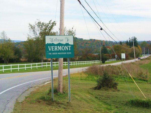
Got a map now for ME-NH-VT. Back to bed.
 |
We didn't stop here to get on the net, but it seemed like a great place to stop just this side of that power pole. Your tail is exposed to traffic coming up from the rear, however. Beyond the pole you're sitting right under the wires.
 Eastbound into PA |
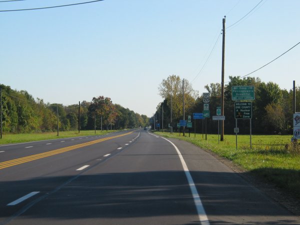
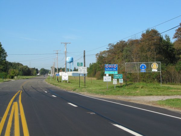 Approaching Conneaut, OH |
Picture 1 is Route 20 eastbound into PA. We parked along the left side. The telephone/power lines were not desirable, but didn't seem to bother too much. Picture 2 is approaching Conneaut, Ohio, (westbound) as we searched for a place to park near the border.
Equipment was an Icom 706MKIIG and High Sierra HS1800 screwdriver antenna with MFJ travel tuner.
 Looking South |
 Looking South |
 Looking North |
 Looking West |
 Looking South |
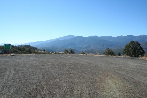
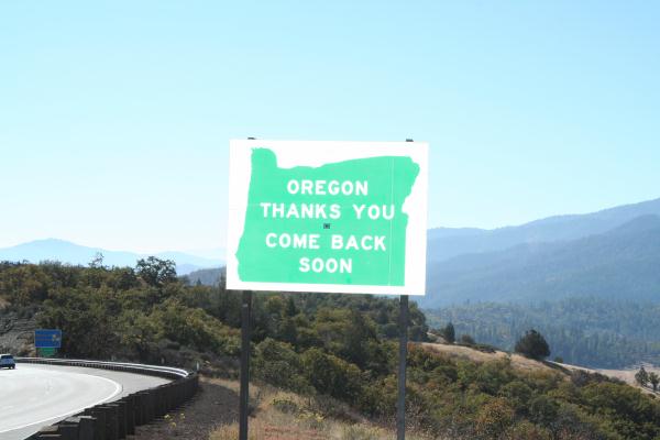
Just barely a pullout on the Oregon side, there is not much to see at this location. It is in the mountains and seems to be a terrific location for amateur radio.
The OR-WA line was the most populous, being the “State Line Road” between the towns of College Place, WA, and Milton-Freewater, OR. The road was a two-lane secondary road so I tried to find an intersection that did not have too much traffic. The coordinates were 46°0.032' North, 118°24.673' West, grid square DN06ta. The elevation was 762 feet. Identification was by the signs “Welcome to Washington” and “Welcome to Oregon” on each side of the road at the intersection with the North/South state road (Rt 11 in OR, Rt 125 in WA). The general area was farm and ranching, wheat, horses and cattle. The take off angle was flat, but there was a power line on the north side of the road and noise conditions were only fair. The OR-WA line was the most populated and there were farms and houses on both sides of the road. Traffic was light, but persistent. Again, three or four stopped to inquire if I needed help.
All the equipment worked well and I feel fortunate to be able to get to all four locations in time to check into the net; and more fortunate that people could work me. I had forgotten that as you go west the UTC time occurs earlier in the day. Another interesting facet is that the sun continues to shine and the whole early net was done in either sunshine or early evening sunset. By my estimate the sunset times were: AZ/UT 0230Z, ID/MT 0245Z, OR/WA 0330Z, CA/NV 0315Z. There was no need for the flashlight and the lamp that I used in previous mobile operations. The sun position meant that I could hear very few stations in the east - although the California, Oregon, Washington, Idaho and other mountain west stations were very 59. At some locations I could not even hear the net until 0100Z, and it was not until 0200 to 0230 that my signals could get east of the Mississippi; by then the eastern stations were swamped with foreign BCI.
If you were going down I-81 there is a good place to operate. (WV/VA LINE) Getting off at the exit at the line, scoot over to Rt 11 (about 0.2 miles), head north and pull into the parking lot of the WADE AUTO EXCHANGE. Not only can you park there generally, but there is a well lit area right there. Was only ever stopped by police once to ask what was happening. A short spiel and let them hear the radio was all needed to show my sincerity. I've operated from there 4 or 5 times now.
 State House |
 |
 |
 |
 |
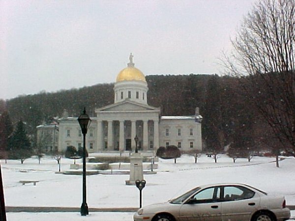
Anyway, Exit 8 off I-89N, onto Rt 2, took a spin down State St., got a couple of pics of the state house, then tried to find a somewhat open area along Rt 2 to set up.
The portable setup was a W3FF “Buddipole” set up as a vertical on a 4' camera tripod with a 31' radial. It was so windy that Friday night I had to set the antenna up close to my work van and tie it off to keep it from being blown over (hence the 6' ladder in pic, to help tie off!)
I had a blast and will go back up in the spring when it is a bit warmer and hope to work 75m also. 73, Neil AE1P
Reference: http://en.wikipedia.org/wiki/Tri-state_area
| Intersection | Tri-point Name, Latitude, Longitude |
|---|---|
| AL, FL, GA | P70 ft 31.0064 -85.0024 Saffold (AL) |
| AL, GA, TN | SL 1 34.9847 -85.6052 New Home (GA) |
| AR, LA, TX | Boundary Mon AR LA TX 33.0192 -94.0430 Ravanna (TX) |
| AR, MO, OK | Boundary Mon AR MO OK 36.4995 -94.6179 Colcord NE (AR) |
| AZ, CO, NM, UT | CO UT AZ NM 36.9990 -109.0452 Teec Nos Pos (AZ) |
| AZ, NV, UT | Boundary Initial Mon AZ NV UT 37.0002 -114.0501 Terry Benches (UT) |
| CO, KS, NE | Boundary Mon CO KS NE 40.0032 -102.0518 Laird (CO) |
| CO, KS, OK | Boundary Mon CO KS OK 36.9931 -102.0421 Sturgis (OK) |
| CA, NV, OR | Boundary Post CA NV OR 41.9949 -119.9995 Barrell Springs (NV) |
| CO, NE, WY | Boundary Mon CO NE WY 41.0017 -104.0532 Pine Bluff SE (WY) |
| CO, NM, OK | Boundary MI Cor CO NM OK 37.0001 -103.0023 Goodson School (NM) |
| CO, UT, WY | GLO 28 CO UT WY 41.0007 -109.0500 Red Creek Ranch (WY) |
| CT, MA, NY | Boundary Bound CT MA NY 42.0498 -73.5214 Ashley Falls (MA)* |
| CT, MA, RI | Tri State 42.0080 -71.7992 Webster (MA)* |
| DC, MD, VA | VA DC MD 38.934473 -77.120642 Washington West (MD) |
| DC, MD, VA | BM 9 38.7930 -77.0393 Alexandria (VA) |
| DE, MD, PA | MDP Corner 39.7225 -75.7886 Newark West (MD) |
| GA, NC, SC | Ellicott Rock 35.0014 -83.1086 Cashiers (GA) |
| GA, NC, TN | P1760 ft 34.9884 -84.3218 Mineral Bluff (GA) |
| IA, MN, SD | P1410 ft 43.5004 -96.4533 Valley Springs (MN) |
| ID, MT, WY | P8330 ft 44.4756 -111.0524 Buffalo Lake NE (ID) |
| ID, NV, OR | Boundary ID OR NV 42.0003 -117.0262 Star Valley Knoll (OR) |
| ID, NV, UT | Three Corners 41.9939 -114.0415 Nile Spring (NV) |
| ID, UT, WY | Boundary Cor ID UT WY BLM 42.0016 -111.0467 Boundary Ridge (ID) |
| IN, MI, OH | Ohio Mich Bdry Cor WP 41.6961 -84.8059 Clear Lake (IN) |
| KS, MO, OK | Boundary Mon KS MO OK 36.9986 -94.6179 Racine (MO) |
| KY, TN, VA | Virginia Corner 2 Reset 36.6008 -83.6753 Middlesboro South (TN) |
| KY, VA, WV | P827 ft 37.5379 -81.9681 Wharncliffe (WV) |
| MA, NH, VT | P60 m 42.7266 -72.4583 Northfield (MA)* |
| MA, NY, VT | Boundary Bound MA NY VT 42.7458 -73.2646 Berlin (NY)* |
| MD, VA, WV | P260 ft 39.3211 -77.7192 Harpers Ferry (VA) |
| MN, ND, SD | P970 ft 45.9353 -96.5634 Boisberg (MN) |
| MT, ND, SD | Boundary Mon 360M 45.9453 -104.0455 Snider Hill (MT) |
| MT, SD, WY | NE Corner Wyoming 44.9976 -104.0577 Gravel Draw (WY) |
| NC, TN, VA | North Carolina Corner Reset 36.5882 -81.6775 Grayson (TN) |
| NE, SD, WY | Chaffee Monument 43.0006 -104.0531 Oat Creek (WY) |
| NJ, NY, PA | Tri States 1942 41.3573 -74.6947 Port Jervis South (NY) |
| NM, OK, TX | Texhomex 36.5005 -103.0024 Rardin Hill (NM) |
| PA, MD, WV | Mon 34 39.7212 -79.4767 Friendsville (MD) |